REQUEST
Map bedrock depth confirmation after drilling campaign.
Bedrock depth was not found by drilling as probably to deep.
SOLUTIONS
To secure what will be done, a deep imaging results up to 500 ft/152 m has been realized.
- Deployments of ultra dense accelerometers array
- Specific processing of low frequencies
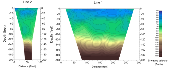
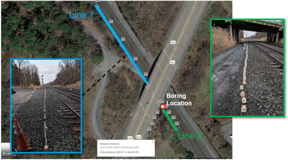
Blue Line 1 : 300 ft/91 m lenght , 100 sensors, 3 ft/90 cm spacing
Green line 2 : 100 ft/30 m lenght, 100 sensors, 1 ft/30 cm spacing
CONCLUSION
- Results show shear wave velocity versus depth up to 200 ft/61 m are consistent between Lines 1 and 2
- The results show that there exists deep silt deposit, relatively uniform up to 200 ft/61 m
- Finally the bedrock is deeper than expected and not accessible by drilling or too expensive by this method.
- Bedrock position is 220ft/67 m deep.